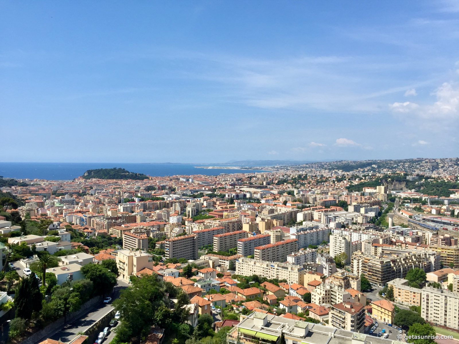
View over Nice from the Moyenne Corniche
From the Moyenne Corniche, the road that climbs out of Nice towards Èze, you look south-west over the whole city: the rooftops of the east of Nice, Castle Hill, the Baie des Anges and the airport, with the Esterel mountains far in the distance. Pick a date and time to see where the sun will be in this view.
Where is the sun?
Turn on JavaScript to see the sun’s position on the photo.
- the sun’s path on the chosen day
- where the sun sets at the solstices and equinoxes
- Sunrise
- –
- Sunset
- –
- Sun in this view
- –
- Golden hour
- –
- Sun direction
- –
- Height above the horizon
- –
Sunset forecast
Estimated from cloud forecasts for this viewpoint and for the sky about 40 km towards the horizon. Forecasts more than 2–3 days ahead are less precise. Pick a day to see it in the view above.
Weather data: MET Norway (opens in a new tab) (CC BY 4.0 (opens in a new tab)); scores calculated by getasunrise.com.
When the sun sets in this view
This is a view for late autumn and winter sunsets: from late October to late February the sun sets inside this frame. In December it goes down just right of the airport, behind the distant Esterel mountains; in November and January it sets a little further right, behind the hills west of Nice. Because the viewpoint is high above the city, the sun stays visible until 2–4 minutes before the official sunset time.
From March to mid-October the sun sets further to the north-west, beyond the right edge of this view, but the evening light over the city and the bay is still worth the stop.
Sunset from here
Photos taken at this viewpoint.

Where it is
Map data © OpenStreetMap contributors (opens in a new tab)
- sunrise direction
- sunset direction
- sun at the chosen time
Moyenne Corniche (D6007), 06300 Nice, France · Open in Google Maps (opens in a new tab)
The Moyenne Corniche is a busy road: stop only where there is a pavement or a safe place to stand off the road.